An Unusual March Polar Vortex Disruption Is Approaching: And It Is Exceptionally Strong
An Unusual March Polar Vortex Disruption Is Approaching: And It Is Exceptionally Strong
Published by WizeMind Australia | March 2026
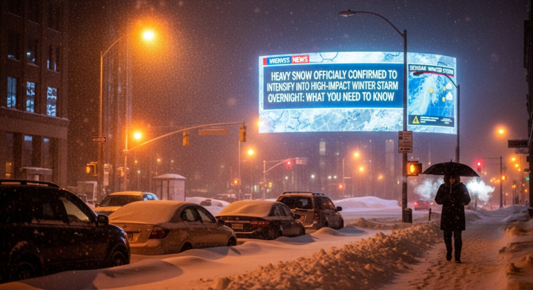
The sky over the northern hemisphere does not usually feel like breaking news in March. By now, winter is supposed to be winding down. The atmosphere slowly exhaling after months of cold, the days stretching longer, the worst of it behind us. But high above your head right now, approximately thirty kilometres up in the stratosphere, something unusual is happening. Something powerful enough to reach all the way down through the layers of the atmosphere and tug at the weather you will feel on your skin in the coming weeks. An exceptionally strong March disruption of the polar vortex is building, and if you pay close attention to the data and the forecasts, you can almost sense the upper atmosphere twisting, buckling, and beginning to come apart at the seams.
The Vortex You Cannot See but Always Feel
Imagine standing outside on a sharp winter night. The kind of night where your breath drifts upward in small pale clouds and the stars look steady and indifferent above you. Everything at ground level seems still. But above that stillness, far beyond the layer of atmosphere where planes travel and storms develop and rain forms, there is a vast spinning mass of frigid air circling the Arctic like an enormous invisible crown of cold. This is the polar vortex.
It is not a storm in the way most people picture storms. It is more like a giant, slow-moving whirlpool of dense, cold air held in place by fierce westerly winds racing counterclockwise around the North Pole. Every winter, as the polar night seals the Arctic in complete darkness and the sun barely touches the horizon for months at a time, this vortex strengthens and tightens. The upper atmosphere cools dramatically. The cold gathers. The winds hold everything in place like a lid on a pressure cooker.
Under normal conditions, this is a stable and reliable feature of the winter sky. Not comfortable, but predictable. A kind of brutal regularity that allows forecasters to describe the season in familiar terms.
But normal is not the word being used right now.
The polar vortex does not always behave itself. Sometimes it is disturbed by waves of energy rising upward from lower in the atmosphere, giant ripples generated by mountain ranges, by intense ocean storms, by the sharp temperature contrasts between different air masses. Think of it as a drum being struck hard from beneath. The vibration travels upward, and if the force behind it is strong enough, the rhythm of the upper atmosphere begins to change.
In early March this year, that force is becoming exceptional. Meteorologists watching temperature and wind profiles in the stratosphere are observing something they describe as a rare and powerful late-season event. A disruption arriving after the winter story was supposed to be nearly finished.
What a Sudden Stratospheric Warming Actually Means
At the centre of this story is a phenomenon known in atmospheric science as a sudden stratospheric warming, abbreviated to SSW. The name sounds clinical and relatively harmless. What it describes is anything but gentle.
Over the course of just a few days, the air high above the Arctic can warm by thirty, forty, or even fifty degrees Celsius. Winds that had been racing steadily from west to east around the pole can slow dramatically, stall, or in the most extreme cases reverse direction entirely and begin flowing the other way. The entire carefully organised structure of the polar vortex, which spent months building itself into a coherent, self-sustaining system of cold, begins to fracture.
The signals this time are exceptionally clear. Forecast models are showing an intense warming event centred directly over the polar cap. Winds at stratospheric levels are weakening far more abruptly than anything typical for March. This is not a minor wobble or a seasonal adjustment. It is closer to the atmosphere’s winter machinery being knocked hard off balance just as the season was beginning to lean toward something gentler.
Most sudden stratospheric warmings happen in the middle of winter when the vortex is fully developed and at its strongest. A disruption this powerful occurring this late in the season is genuinely uncommon. March is the time when the vortex is expected to gradually fade and dissolve as sunlight returns to the Arctic and the upper atmosphere begins its slow seasonal warming. It is not supposed to shatter. And that timing matters considerably, because the atmosphere in March is already in transition. Caught between the fading memory of winter and the first genuine movement toward spring. When the vortex is violently disturbed at precisely this moment, the consequences ripple through a system that is already primed for change and therefore more sensitive to disruption than it would be in the depths of January.
How It Travels from the Stratosphere to Your Front Door
The polar vortex lives at an altitude most people will never visit and cannot directly experience. So what does an exceptionally strong March disruption actually feel like when you are standing on the ground waiting for a bus or planning a weekend in the garden?
The influence does not arrive immediately. It descends gradually, over one to three weeks, working its way down through the layers of the atmosphere from the stratosphere into the troposphere, the layer closest to the surface where clouds form and weather actually happens.
As it descends, the disruption tilts weather patterns toward less predictable and often more extreme configurations. High-pressure systems can settle and park stubbornly over regions, blocking the usual movement of weather and forcing cold air southward in some places while pulling unusually warm air northward in others. The established paths that storm systems prefer to travel can shift significantly. Regions that should be experiencing the first genuine warmth of the year can find themselves dragged back into conditions that feel more like January. Others may jump forward into something that belongs to April or even May.
In previous strong disruptions, Europe experienced sharp late-season cold snaps with snowfall and deep frost arriving precisely when people had already put away their winter coats. Parts of North America saw weather that felt like a final brutal punch from Arctic air after a relatively mild mid-winter, while in other situations a strong blocking ridge locked in unusual warmth and dry conditions instead.
This kind of event does not dictate a single uniform outcome. What it does is significantly increase the probability of weather that feels out of step with the season. The atmosphere is a continuous, restless ocean of air. Once its upper layers are disturbed this severely, the turbulence will eventually break through to the surface somewhere, expressed as weather that catches people off guard.
To understand how the current event compares to others in recent memory, it helps to look at a few notable examples side by side:
- The February 2018 sudden stratospheric warming was very strong and produced the event widely known as the Beast from the East across Europe, bringing deep cold, heavy snow, and widespread disruption at the tail end of winter
- The January 2021 vortex weakening was strong but complex in structure and contributed to the severe cold outbreak that caused the catastrophic Texas freeze and associated power failures
- A typical late-winter vortex fade between March and April involves gradual weakening and produces a smooth and relatively unremarkable transition into spring patterns
- The current March disruption involves exceptionally strong and unusually late breakdown with increased risk of sharp pattern reversals, late-season cold in some regions, and spring-like warmth surging into others
Seen alongside those historical events, the present situation stands out not only for its measured strength but for where it falls in the seasonal calendar. Arriving as the atmosphere was already shifting toward spring gives it an unusual degree of influence over what the coming weeks will actually feel like.
Why Forecasters Are Calling This One Exceptional
The word exceptional appears in meteorological language with some care. Forecasters do not reach for it easily. In atmospheric science, the strength of a polar vortex disruption is assessed through specific measurements. How completely the characteristic westerly winds at stratospheric levels slow or reverse. How dramatically the temperature rises in the polar region. How large an area is affected and how quickly the changes unfold.
On every one of those measures, what the models are currently showing qualifies for the description.
Think of the polar vortex as a spinning top moving across a smooth surface. In a typical March it is already wobbling, gradually losing momentum as sunlight returns to the high latitudes and the energy source that sustained it through winter begins to weaken. What is happening now is less like a wobble and more like someone delivering a sharp sideways blow to that top while it is already losing its balance. The result is a more chaotic, elongated, fragmented structure. No longer the tight, coherent ring of cold that defined the winter. Instead a disjointed and unstable system with large lobes of frigid air sitting in positions where they can be displaced southward into populated mid-latitude regions.
Part of what is driving this particular event is an unusually strong upward push of atmospheric wave energy from lower in the atmosphere. These waves originate from places where fast-moving air encounters mountain ranges, or where sharp contrasts between warm and cold ocean surfaces generate powerful storm systems. When multiple sources of wave energy converge and amplify at the same time, they pour into the stratosphere with enough force to break the polar vortex apart rather than simply disturbing it.
Beneath all of this is a background climate that has changed considerably from what it was even a few decades ago. The Arctic is warming at roughly four times the rate of the global average. Sea ice extent has declined significantly over several decades. The temperature contrasts that once defined the relationship between the Arctic and the mid-latitudes have shifted. Scientists are still working to fully understand how these long-term changes interact with specific vortex events, and the research is genuinely complex. But the stage on which this disruption is unfolding is demonstrably different from the stage on which earlier events played out.
It is important to be clear about what this does and does not mean. A strong polar vortex disruption does not create winter from nothing, and it does not erase the overall warming trend. What it does is redistribute and intensify the range of weather that is possible in the weeks immediately following the event. It amplifies contrasts, making cold snaps colder where Arctic air is released and warm surges warmer where milder air is pulled in to replace it.
What the Coming Weeks Could Look Like
If you live in the mid-latitudes of the Northern Hemisphere, whether in North America, Europe, or parts of Asia, this atmospheric event may soon make itself felt in the most ordinary aspects of daily life. The precise details depend on your specific location and how the jet stream responds as the disruption works its way down to the surface. But the broad directions of risk are relatively clear.
For regions that are typically prone to late-season cold, the probability of a sharp return to winter conditions increases meaningfully. Snowstorms can materialise out of what appeared to be genuine spring. Strings of nights cold enough to damage early blossoms and tender plants that had already emerged in the warmth of what seemed like an early spring. Farmers assessing fields and gardeners who have already started planting may need to pause and reconsider their timing.
For other regions, particularly those positioned downstream of the new high-pressure systems that commonly develop following a vortex breakdown, the disruption may produce the opposite effect. Unusually warm and dry periods stretching longer than the season normally allows. That can sound appealing after a long winter, but extended early warmth accelerates soil drying, triggers allergy seasons earlier than expected, and creates conditions that can confuse ecosystems and agricultural systems tuned to more predictable seasonal rhythms.
If you could watch the jet stream directly, those fast and narrow ribbons of wind that steer weather systems across the hemisphere, you would see it bending into larger and slower loops than usual. In one part of a loop, a deep trough could pull Arctic air southward into regions that had no expectation of it. In another, a high-pressure ridge arching northward could push unusually mild air into areas that should still be cold. The two things happening simultaneously, in different places, is one of the most disorienting aspects of a major vortex disruption from a public perspective.
The most unsettling element for many people is not the cold itself or even the warmth. It is the feeling of instability. The sense that the season cannot decide what it wants to be. One week you are shed layers and opening windows and feeling that the worst is genuinely behind you. The following week you are scraping ice from the windscreen and searching for gloves you thought you would not need again until autumn.
How to Stay Ahead of a Sky in Flux
There is something genuinely humbling about realising that your plans for the coming month, your commutes and your garden schedule and your morning runs and your travel, are being quietly rearranged by events unfolding thirty kilometres above your head in an atmospheric layer you have never directly encountered and never will.
The polar vortex is a reminder, delivered occasionally and without much consideration for human convenience, that the atmosphere is not merely a backdrop to daily life. It is a living, restless, interconnected system with its own tensions and its own tipping points, and those tipping points produce consequences that eventually reach all the way down to the surface you are standing on.
Living through a disrupted vortex does not require panic or dramatic preparation. It rewards attention and flexibility. If your region carries any history of late-season weather instability, a strong March event is a reasonable prompt to stay informed more actively than usual. A sunny and settled ten-day forecast is worth keeping an eye on rather than simply trusting, because it can shift as new pattern changes cascade downward from the stratosphere into the troposphere.
For gardeners and growers, building in extra caution around planting dates and having frost protection ready longer than would normally feel necessary is a sensible response rather than an overcautious one. For anyone planning outdoor events or activities that depend on settled weather, keeping contingency options available is simply wise.
Practical things worth doing over the coming weeks:
- Check local forecasts more frequently than usual and look for pattern change warnings from meteorological services
- Gardeners and growers should delay planting of frost-sensitive varieties and keep protective coverings accessible
- Be prepared for weather that swings more dramatically between cold and mild than a typical late winter or early spring
- If you live in a region with infrastructure sensitive to late cold snaps, check that heating systems and weather-related preparations have not been fully stood down for the season
- Farmers and orchardists should monitor overnight temperatures carefully and be ready to protect vulnerable crops or blossoms
The Atmosphere Writing a Less Predictable Script
On a more reflective level, this unusual disruption is an invitation to pay attention to the sky in a way that daily routines rarely encourage. When you step outside on a calm evening in the coming weeks and notice something that feels slightly off about the temperature or the direction of the wind, or the way cold arrives with a different quality than you expected, you are sensing the distant fingerprints of something enormous happening far above you.
Weather has always had its surprises. Seasons have always had their reversals and their moments of confusion. But the combination of a background climate that is measurably different from previous generations and an atmosphere that is responding to those differences in ways that are still being studied and understood means that the surprises can arrive with greater intensity and at less expected moments than the historical record would suggest.
High above you right now, the polar vortex is coming apart. The process is slow by human standards but rapid by the standards of atmospheric science. The cold air that it has been organising and containing for months is beginning to escape its boundaries. The jet stream is adjusting to the new configuration. Weather patterns that had been following a relatively predictable seasonal track are beginning to change their course.
You cannot see any of it. But in a week or two, or perhaps in three, you will almost certainly feel it. In the unexpected frost on the windscreen one morning, or in the unseasonable warmth that settles over a week when you expected grey skies and cold rain, or in that particular atmospheric restlessness that makes it difficult to dress for the day because the day itself does not quite know what season it belongs to.
That is the polar vortex reaching down from its invisible altitude and reminding you, as it does every few years in ways more dramatic than others, that the sky above your head is not a fixed and stable ceiling. It is a dynamic, powerful, and occasionally surprising presence. And right now, in this unusual March, it is in the middle of something exceptionally strong.
Read More: For more weather explainers, science stories, and environment coverage written for Australian readers, visit wizemind.com.au